Trail Riding Etiquette
Trail Riding Guidelines
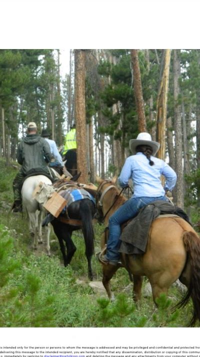
We adhere to the 12 heartbeats rule to minimize our impact on the trails we ride. This means a maximum of six horses and six riders per group. If there are more than six riders, we split into two groups.
Pre-Ride Preparation
- Shoeing Recommendations: Riders should carefully review descriptions and suggestions regarding the need for horseshoes based on the terrain.
- Required Documents: Riders must obtain necessary documents in advance, including:
- Coggins test
- Health Certificate (for out-of-state rides)
- Brand Certificate (for rides over 75 miles from home)
- Horse and Rider Readiness: Members respect other riders by ensuring their horses are conditioned for the distance and terrain. Riders should also honestly evaluate their own abilities and limitations, as well as their horse's condition and readiness, before attending a ride.
During the Ride
- Preparedness: While we understand that unexpected issues like tack malfunctions or injuries can occur, all riders are expected to plan ahead to ensure the ride is as safe and enjoyable as possible.
- Self-Sufficiency: Riders are responsible for bringing their own food, water, and first aid supplies unless otherwise noted in advance.
- Punctuality: If the ride is scheduled to meet at 10:00, please arrive promptly.
Guidelines for Trail Bosses
Trail bosses serve as the point of contact for scheduled rides. Their duties include:
- Providing Accurate Information:
- Verify and communicate details about the trail difficulty, gear requirements, and food needs as listed on the website calendar.
- Communicating Ride Details:
- Clearly convey the ride’s difficulty level, pace, and length to all riders.
- Following Leave No Trace (LNT) Principles:
- Ensure that riders follow LNT practices to protect the environment.
- Implementing the 12 Heartbeats Rule:
- Monitor group sizes to comply with this rule and split into smaller groups if necessary.
- Managing the Ride Pace:
- Observe the pace of each horse and rider, making adjustments as needed.
- Trail Knowledge:
- Be familiar with locations for watering horses, grazing areas, and suitable lunch stops.
Featured Trail Locations

Larimer County Parks
Colorado Parks and Wildlife
Larimer County Parks
https://www.larimer.org/naturalresources/parks
Eagles Nest Open Space
Located near Livermore, CO, Eagles Nest Open Space features rolling hills, creek crossings, and flat land riding. It also provides access to National Forest trails for extended rides.
Lone Pine Trail
West of Livermore on Red Feather Lakes Road (Larimer County Road 74E), L
https://www.larimer.org/naturalresources/parks
Eagles Nest Open Space
Located near Livermore, CO, Eagles Nest Open Space features rolling hills, creek crossings, and flat land riding. It also provides access to National Forest trails for extended rides.
Lone Pine Trail
West of Livermore on Red Feather Lakes Road (Larimer County Road 74E), Lone Pine offers trails that follow the creek for a couple of miles with several water crossings. Shoes or boots are recommended. A significant portion of the ride follows an old two-track roadbed.
Fort Collins Area
Colorado Parks and Wildlife
Larimer County Parks
http://www.fcgov.com/naturalareas/finder
Red Mountain Open Space and Soapstone Open Space
These open spaces are popular destinations for equestrians. Both areas offer free entry, making them accessible and budget-friendly. Please note that the roads leading into these areas can be rough at times, so plan accordingly.
Colorado Parks and Wildlife
Colorado Parks and Wildlife
Colorado Parks and Wildlife
How to Explore Trails
Click on Things to Do and choose your activity from the drop-down menu.
Lory State Park
Lory State Park is a favorite riding destination in the area, offering a variety of trails. Riders can explore lower, easier trails or connect to the Soderberg Open Space system for more challenging routes.
A wide
How to Explore Trails
Click on Things to Do and choose your activity from the drop-down menu.
Lory State Park
Lory State Park is a favorite riding destination in the area, offering a variety of trails. Riders can explore lower, easier trails or connect to the Soderberg Open Space system for more challenging routes.
A wide array of trails is available through the link above. Please note that a fee is required for entry to Lory State Park. Currently, the fee is $7.00 per day.
Fort Robinson State Park
Mount Margaret and Lady Moon Trails
Fort Robinson State Park
Located near Crawford, NE, this is a must-visit riding paradise! While some areas of the trails are not well-defined, you can ride here for hours, enjoying the expansive scenery. For an added adventure, you can even ride into Crawford.
This site is a former cavalry fort that has been beautifully preserved. The origin
Located near Crawford, NE, this is a must-visit riding paradise! While some areas of the trails are not well-defined, you can ride here for hours, enjoying the expansive scenery. For an added adventure, you can even ride into Crawford.
This site is a former cavalry fort that has been beautifully preserved. The original cavalry stables, once used by regiments in the 1800s, including the famous 10th Cavalry, remain intact and add a unique historical charm to the experience.
Pawnee Buttes
Mount Margaret and Lady Moon Trails
Fort Robinson State Park
The Buttes
Located in a remote region of northeastern Weld County, the Buttes offer an easy ride through fascinating geological formations from Earth’s ancient past. Shoes or boots are not required.
Directions:
- From Highway 14 in Ault, CO, travel approximately 30 miles east.
- Turn north onto County Road (CR) 390 and continue for about 14 mile
The Buttes
Located in a remote region of northeastern Weld County, the Buttes offer an easy ride through fascinating geological formations from Earth’s ancient past. Shoes or boots are not required.
Directions:
- From Highway 14 in Ault, CO, travel approximately 30 miles east.
- Turn north onto County Road (CR) 390 and continue for about 14 miles.
- Turn east on CR 112 and travel to CR 107, approximately 6.5 miles.
- Turn south on CR 107 and drive for about 2 miles to CR 685.
- Turn east on CR 685 and continue for 1.2 miles to reach the trailhead.
This route is part of a designated Scenic Byway, with signs posted along the way. Please note that the county roads are gravel and may be rough in some sections.
Mount Margaret and Lady Moon Trails
Mount Margaret and Lady Moon Trails
Mount Margaret and Lady Moon Trails
These trailheads are located across from each other on Larimer County Road 74E (Red Feather Lakes Road), approximately 18 miles from the Highway 287 junction in Livermore, CO.
Trailhead Features:
- Both trailheads offer vault toilets and parking for up to six rigs.
- Shoes or boots are recommended due to a few rocky sections on the trails.
- The Mo
These trailheads are located across from each other on Larimer County Road 74E (Red Feather Lakes Road), approximately 18 miles from the Highway 287 junction in Livermore, CO.
Trailhead Features:
- Both trailheads offer vault toilets and parking for up to six rigs.
- Shoes or boots are recommended due to a few rocky sections on the trails.
- The Mount Margaret side includes at least one creek crossing.
- The Lady Moon side connects to the Elkhorn Trail system and the Molly Lake Trail system.
Elkhorn Trailhead:
Located off CR 68C (commonly known as Boy Scout Road), the Elkhorn Trailhead features water crossings and a lesser-used trail system, providing a quieter experience for riders.